.png)
Well Planning
to Well Completion
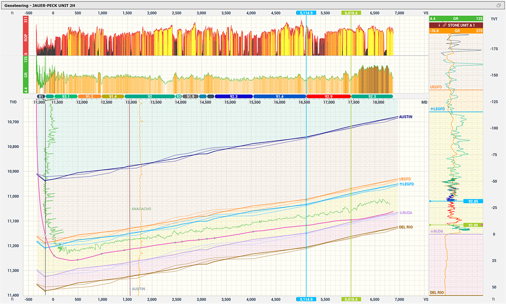
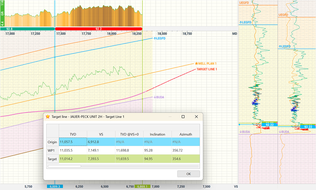
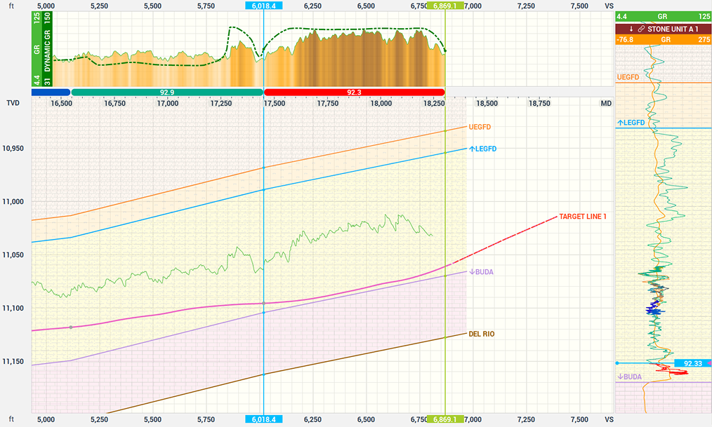
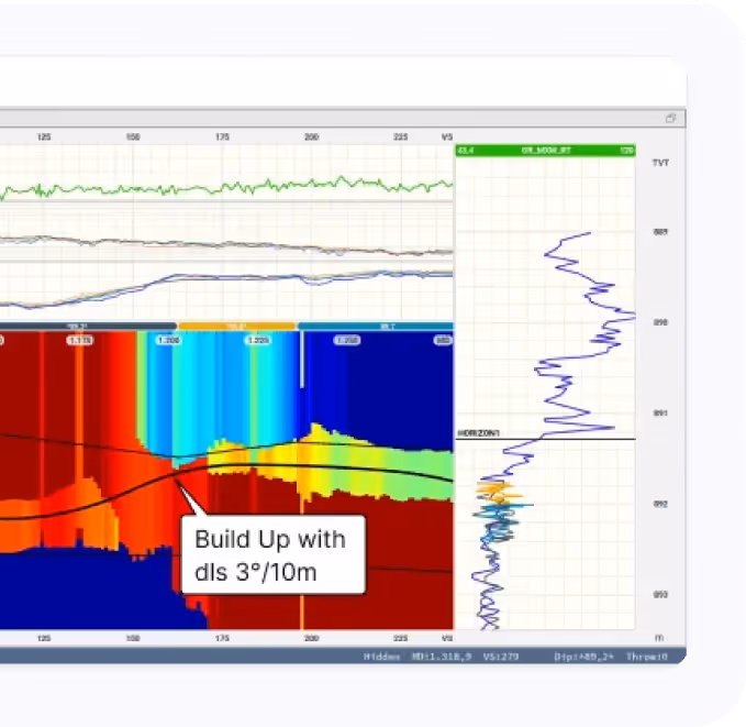
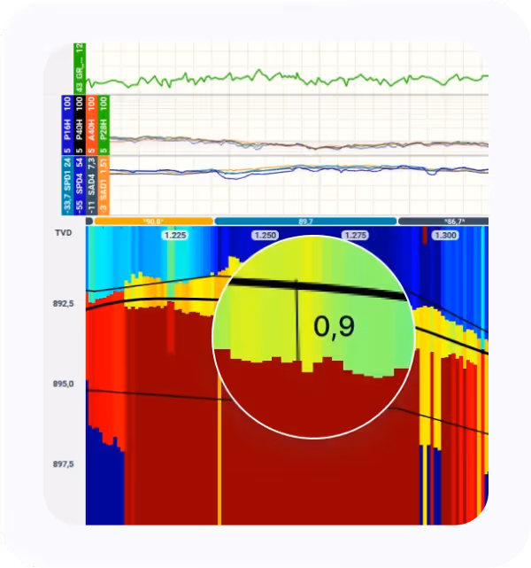
Geosteering
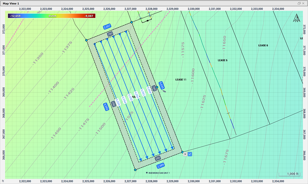
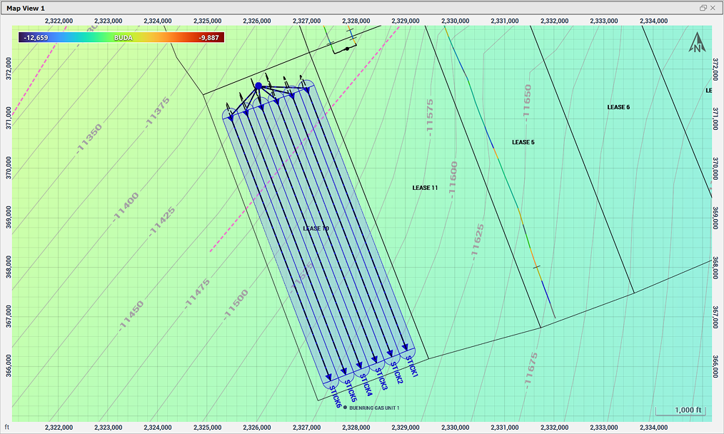
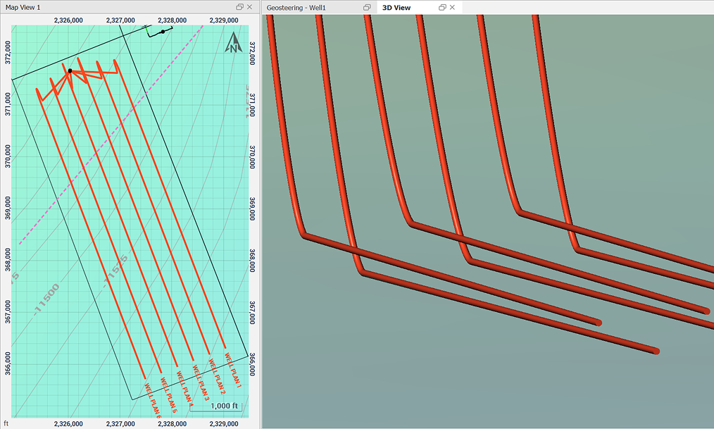
Wellbore Planning Optimization
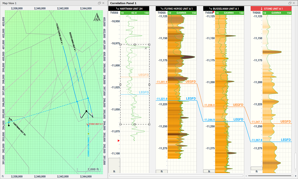
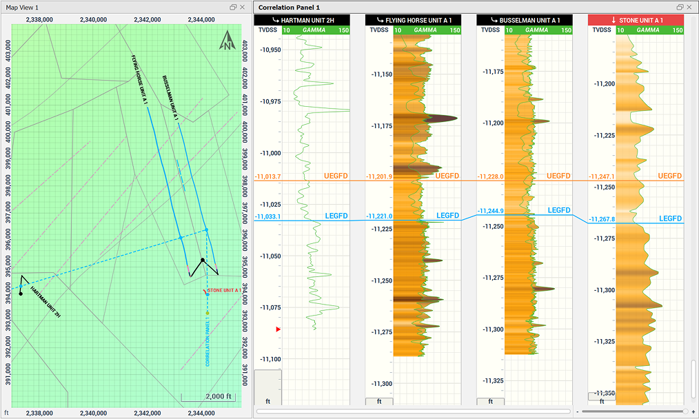
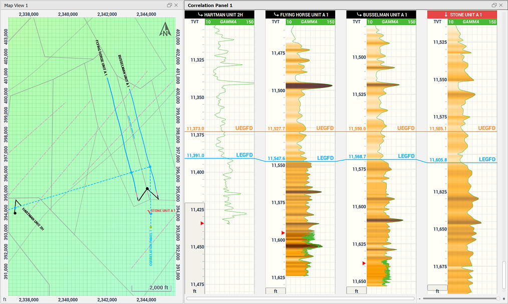
Well Correlation
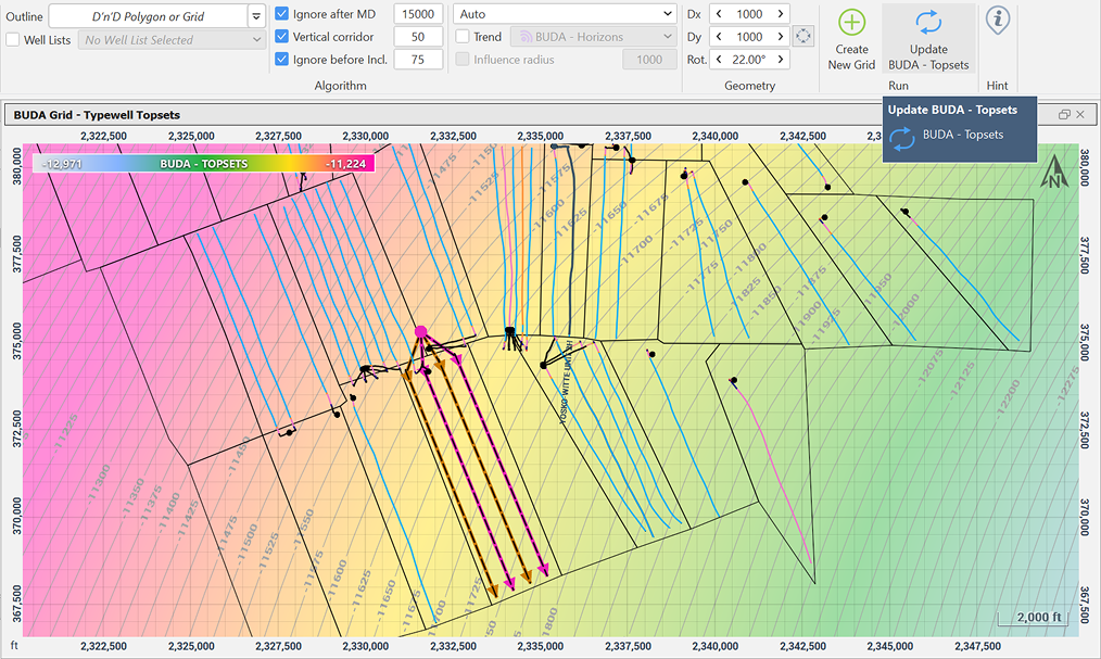
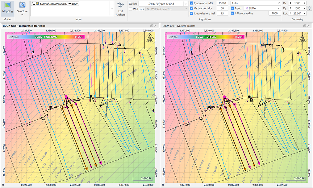
Subsurface Geological Mapping
Stochastic
Inversion
Take control of your pre-job, real-time, post-job resistivity workflows with vendor independent multilayer inversion.
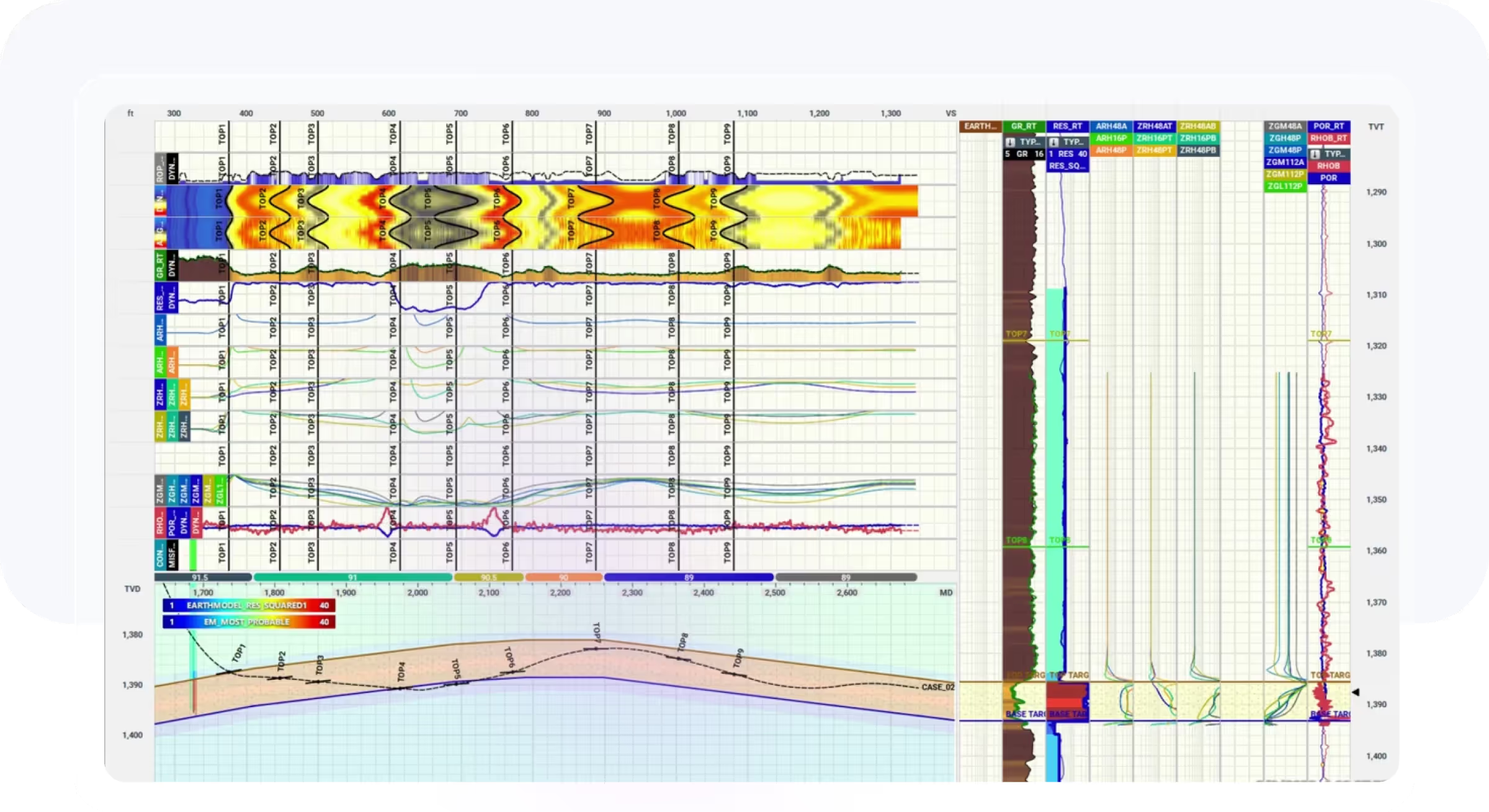
Simultaneously compare different vendors tool response against your specific reservoir geology to identify the most suitable tool and resistivity curves.
Monitor accuracy with P10, P50, P90 confidence inversion.
Incorporate all memory data to create high accuracy final inversions. Deploy the inversion module on High Performance Computing (HPC) devices for fast results.
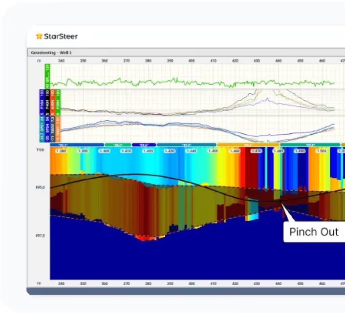
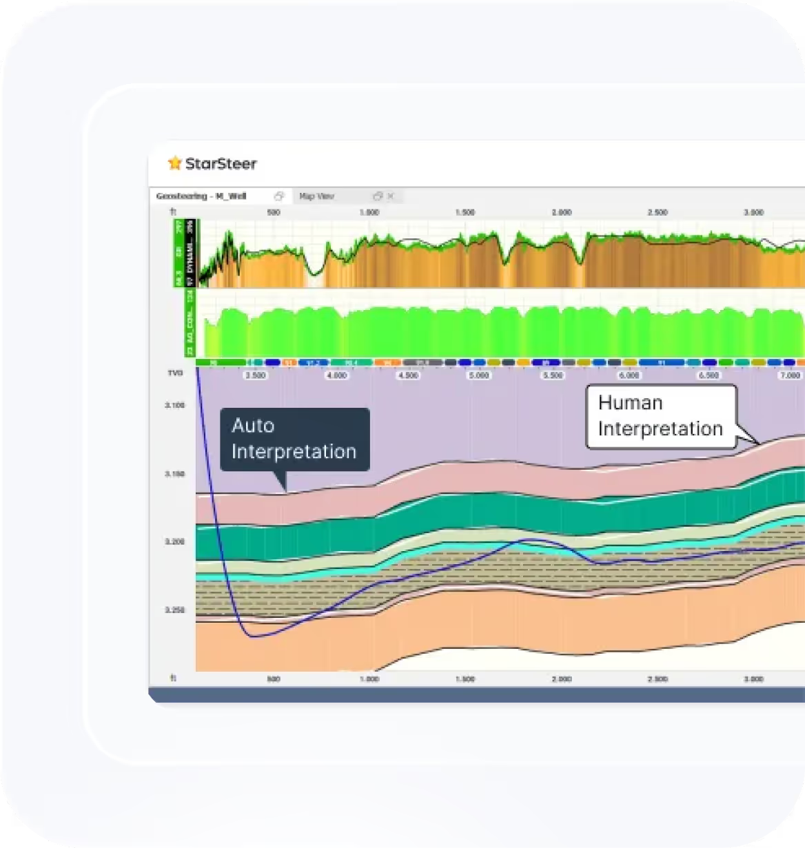
StarSteer
GeoAssist
StarSteer's Auto Steer Tool makes geosteering easy. It's machine learning algorithm is trained on 1000s of wells across numerous reservoirs.

Every geologist has a pre-drill bed model in mind. Sometimes it is wrong. Have Auto Steer provide you a completely unbiased interpretation.

Recently acquired new acreage? Cut your resteer time by 80% and get your results quicker!

Set up a WITSML connection and monitor Auto Steer from your phone using the StarLite app.
%201.avif)
ROGII Advances Reservoir Mapping with Ultra-Deep Azimuthal Resistivity Data Inversion
ROGII Advances Reservoir Mapping with Ultra-Deep Azimuthal Resistivity Data Inversion
Read Case StudyRequest a License
Try it out yourself. We will train you in under 2 hours to steer your first well.


