
Central Hub for Well Data
Data Manager is a web-based data management platform for geologists, engineers, and operations teams to access, organize, and analyze well data in one place.

Visualise, Organize, and Manage All Your Well Data in One Place
Geosteering
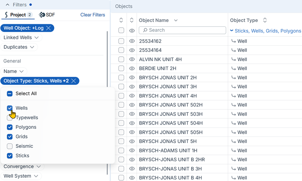
Search, Filter, and QC Well Data with ease


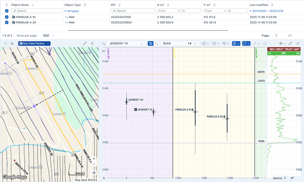
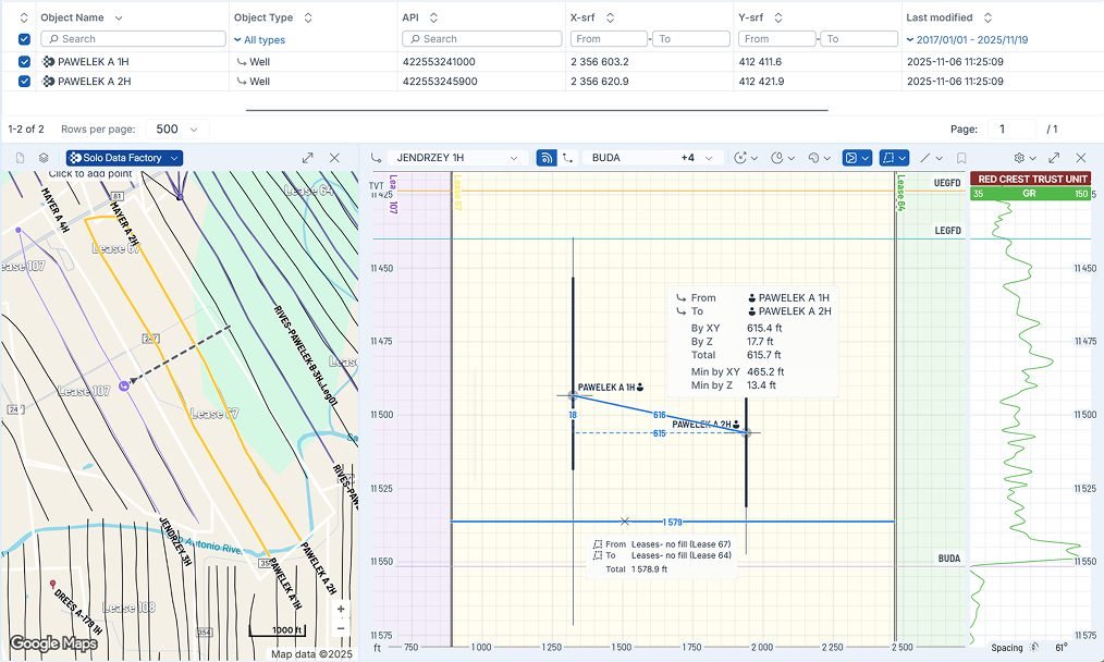
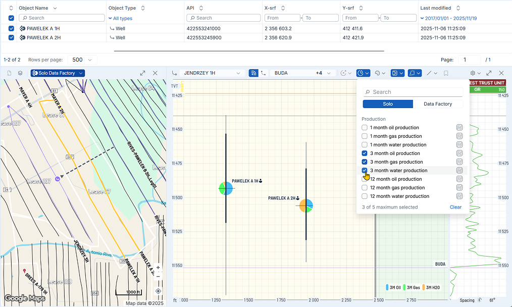
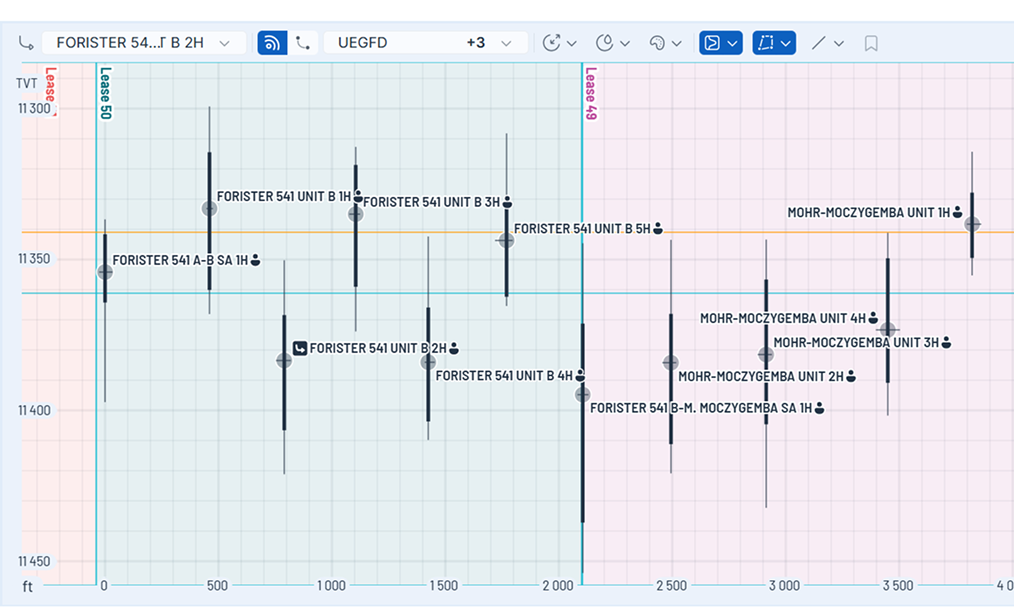
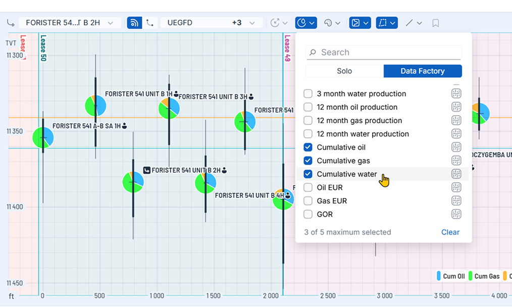
Generate Gun Barrel Plots
for Better Well Placement
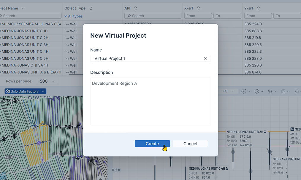
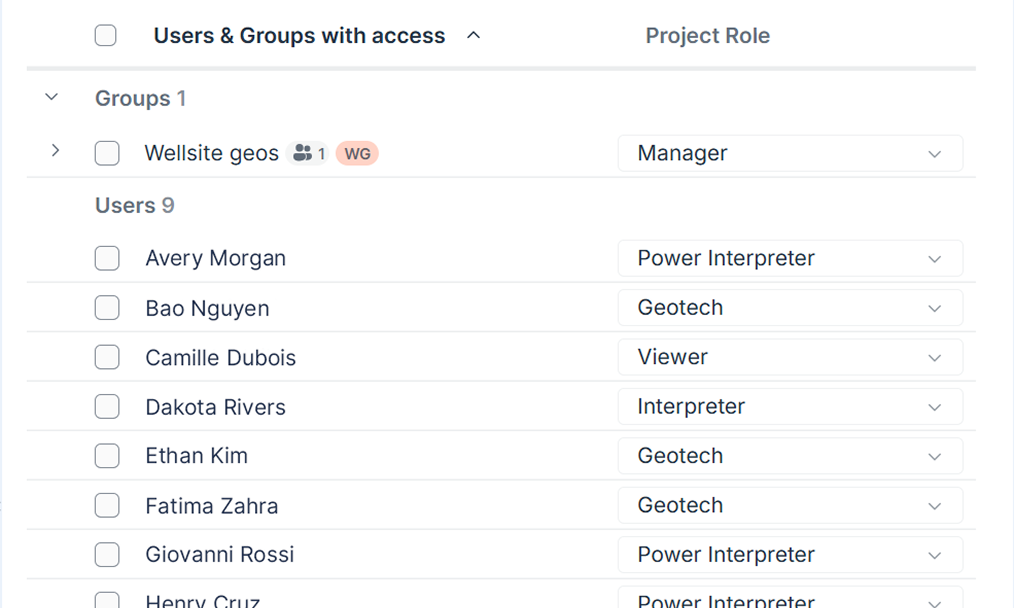
Control Access with Virtual Projects
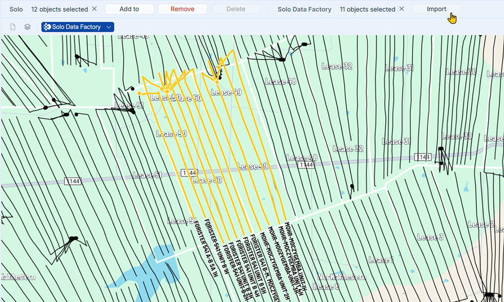
Solo Data Factory
Solo Data Factory (SDF) is ROGII’s operations-focused regulatory data hub for onshore field development.
Book a Data Manager demo
With Data Manager all of your data is secure and available for multi-disciplinary real-time, collaboration.

Blog Post: The Power of the Gun Barrel Plot
As drilling challenges grow, precise visualization is key. ROGII’s Gun Barrel Plot in Data Manager, the primary interface for Solo Cloud, provides a powerful way to analyze well data, offering critical insights into the competitive wellscape and helping teams make informed decisions.
Read Blog Post


