Beyond the Static Reports: How StarLite Gives Drilling Engineers Real-Time Control
In the high-stakes world of drilling, there’s a classic tug-of-war often referred to as the "Game of Zones." On one side, the directional drillers want to drill as fast as possible. On the other, the geologists are sweating over the interpretation, trying to stay in the target window. Historically, these two groups have communicated through static twice-daily emails that are often outdated by the time they’re read.
In a recent ROGII University webinar, Diane Cillis (a former Chevron Drilling Supervisor turned Technical Sales Analyst) broke down how StarLite is bridging this gap. Here’s why StarLite Web is becoming the essential "third eye" for drilling engineers and rig teams.
1. Real-Time Data, Not "Static" History
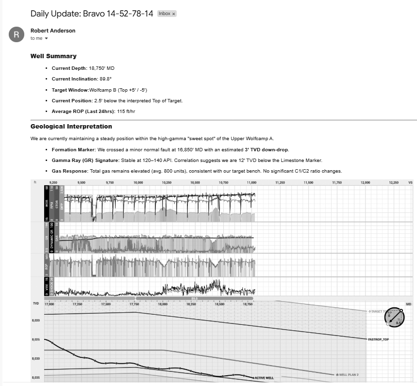
The biggest pain point for rig teams has always been the lag in information. Engineers often receive a PDF summary in the morning only to realize the interpretation changed overnight:
The StarLite Benefit: Engineers can see exactly what the geologist sees, as it happens. When the geo team updates a horizon or shifts a dip angle, it reflects immediately in StarLite. This allows the drilling team to ask the right questions, like "What can we do about the high shock and vibration?" while the bit is still on bottom, not eight hours later.
.png)
2. Identifying Trends Before They Become Problems
StarLite allows engineers to overlay drilling traces (like RPM, Weight on Bit, and Torque) directly onto geological interpretations.
- Shock & Vibration: By viewing vibration data alongside geological horizons, teams can identify if a specific formation is causing BHA damage.
- Slide vs. Rotary: The software color-codes the well path to show exactly where the team was sliding versus rotating, providing instant averages for motor yields and ROP for each interval.
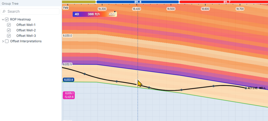
- The "Sweet Spot" Heat Map: One of the most powerful features is the ROP Heat Map. By pulling data from offset wells, StarLite creates a "weather map" of the formation. Engineers can see exactly where the fastest drilling rock is located within the target window and coordinate with the DD to steer toward it.
3. The Power of the "Widget"
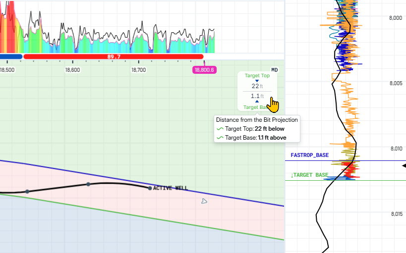
Engineers don't always have time to do complex math on the fly. StarLite includes a real-time widget that acts as a "Well Health Check." At a glance, you can see:
- In-Zone Percentage: Exactly how much of the lateral has stayed in the target.
- Distance to Exit: A countdown (in feet) of when the current trajectory will exit the top or base of the window.
Reference Points: Instant distance measurements to the target top, base, and the original well plan.
4. Understanding TVT (True Vertical Thickness)
For many engineers, TVT is a "geo term." However, StarLite makes it practical. By using the TVT Track, engineers can see the formation normalized for thickness. This helps the team understand if they are drilling into a thinning part of the reservoir, allowing for better-informed steering decisions that balance ROP with reservoir quality.
5. Decision-Making on the Go
You shouldn't have to be at a desk to know if your well isin trouble. The StarLite Mobile App (available on iOS and Android)brings the entire cross-section to your phone.
- Well Cards: Get a quick snapshot of all active wells.
- Ruler Tool: Measure distances between horizons with a simple two-finger gesture.
- DDR Integration: View Daily Drilling Reports and activity breakdowns (drilling, reaming, in-slips) directly alongside the geo-steering data.

The Bottom Line
As Diane Cillis put it, "Communication is key. "StarLite isn't just a viewing tool; it’s a communication platform. It empowers drilling teams to move away from blaming the "mud" or the"geo" and toward making data-driven decisions that save time, reduce sidetracks, and maximize ROP.
Ready to see it in action? You can check out the full ROGII U Webinar here on Youtube!


